Unusual Winter Weather Persists In The South

A beautiful picture of a tree lined road in winter covered in snow.

May 2, 2013 winter storm

Temperatures fell over 30 degrees in numerous Midwestern and Southern US states when an unseasonable May storm dropped more than a foot of snow across the central Plains  and the upper Midwest on May 2, 2013. The winter storm dumped about 18 inches of snow across parts of northern Wisconsin, and more than 15 inches fell in southern Minnesota, according to the National Weather Service.

Trace amounts of snow fell in the panhandles of Texas and Oklahoma, and more than 10 inches of rain fell in parts of Mississippi and Alabama.

Just A Freak Storm Or Evidence Of A Pole Shift?

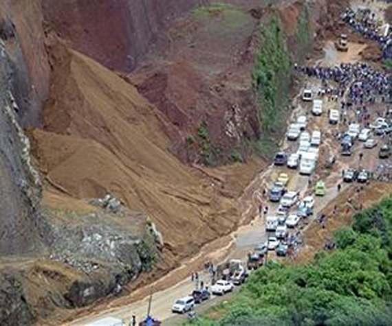
This strong winter storm – in May – is no accident or freaky coincidence because anything that happens on the Earth, happens for a reason. Freaky storms just don’t appear – something triggers them.

Pole Shifts Are Speeding Up

A picture of the earth's magnetic field.

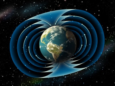
The Earth’s North and South Magnetic Poles

The NOAA National Geophysical Data Center maintains a data set of annual magnetic north pole coordinates going back to the year 1590. After studying 420 years of north magnetic pole position data, NOAA configured that the degree of the magnetic pole shift over the past 10 to 20 years has sped up substantially[i].

The pole shifts, both the magnetic poles and the geographic poles, have remained at 400-year record highs during the 21st Century, and the cumulative effect is now beginning to cause real-world issues. At the current rate of polar wandering, there is little doubt that this will result in direct effects all over the planet in the years ahead. Navigational charts and maps will need to be constantly adjusted, and GPS navigation will be impacted, as will most modern technology.

A Mirror Image

On all of the terrestrial planets in our solar system, the magnetic poles and the geographic poles mirror one another. In other words, the poles stick close together. So, if the magnetic poles wander and shift, the geographic poles follow.

A shift at the North Pole, no matter how small a shift, will have a trickle-down effect all over the planet. This “shift” creates changes in global climate patterns, shifts in the Jet Stream, relocates the ocean currents, and creates an increase in earthquakes, volcanoes, violent storms, wildfires, and tsunamis.

So, this May winter storm was no freak accident. We witnessed an Earth “shift.”


[i] NOAA National Geophysical Data. British Geological Survey. April 11, 2011.

At Least 14 Killed In Second Major Landslide in Ecuador This Year

A picture of the deadly landslide in Ecuador on April 24, 2013.

Deadly landslide in Ecuador on April 24, 2013 – AP

A landslide in the town of Tabete in Ecuador’s Esmeraldas Province claimed the lives of at least 14 people on April 24, 2013 and buried several homes. Heavy rains appear to have triggered the landslide that struck the village of Tabete in northern Ecuador. Reports said that the landslide occurred after the soil in the community was saturated by hours of continual heavy rains.

Three months earlier and to the day on January 24, 2013, a landslide set off by mining and rains killed 10 and injured 18 others in the gold mining community of Pueblo Nuevo, located about 340 kilometers (210 miles) southeast of Quito, the capital of Ecuador.

A picture of a deadly landslide in Ecuador on january 24, 2013.

Deadly landslide in Ecuador on January 24, 2013 – AP


5.2 Vanuatu And 5.3 Solomon Island Quakes Cause Flood Advisory For Hawaiian Islands

An USGS map of the Vanuatu island chain in the South Pacific Ocean.

The Vanuatu island chain in the South Pacific Ocean – USGS

The Pacific Rim woke up again on Wednesday morning. After another 6.5 magnitude quake hit the New Ireland Region of Papua, New Guinea in the midnight hours, Vanuatu started the day with a 5.2 magnitude quake, followed by a 5.3 on the Solomon Islands. These large earthquakes exacerbated flooding on the Hawaiian islands and along the island chains north of Australia and New Guinea.

Remember to keep an eye on earthquakes along the Vanuatu island chain – when big ones start in this island region, they create a chain reaction around the world.

Hawaii Under Water

Because of Hawaii’s location in the Pacific Ocean, large earthquakes occurring along the Pacific Rim (Ring of Fire) can create the threat of tsunami waves that travel toward this vulnerable island chain. Earthquakes from Alaska to the west coast of South America, as well as quakes on the western side of the Ring of Fire create underwater vibrations that “paddle” large waves into Hawaii’s path.

Less than a decade ago, you could count on one hand the number of large earthquakes occurring along the Ring of Fire . Today, the increase in significant earthquakes is occurring weekly, and now – daily. 

Will Hawaii get a break from the stirring ocean waters? Probably not as more earthquakes increase worldwide, and along the Ring of Fire.

Surf’s Up!