Floods In Hawaii And More To Come

A tropical beach with clouds raining over it.

Heavy rains are causing flooding in Hawaii.

Heavy rains and runoff are causing flood advisories in Hawaii. If the heavy rains persist, the advisories will be extended.

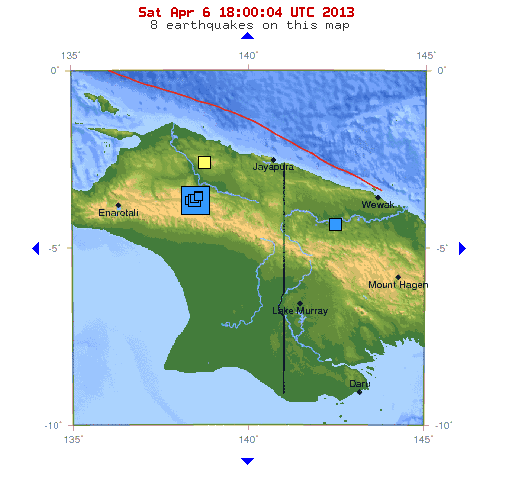
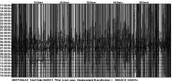
To top this off, a 7.2 magnitude earthquake struck east of Balilihan, Philippines early morning October 15, 2013, and although tsunami warnings for Hawaii were not issued, high waves will be rolling into the upper Hawaiian Islands.

This will exacerbate heavily flooded areas.

High waves crashing on the sea shore.

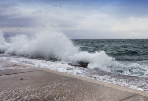
High waves will reach the Hawaiian Islands after the 7.2 quake in the Philippines.

Advisory

A flash flood watch through Tuesday has been issued for the State of Hawaii. The entire Island of Lanai is under flood advisory, as well as the Big Island, Oahu, Kauai, Waianae, Maui, Haleakala, and Kona.

The Island of Molokai was under flood advisory, but that was cancelled once the heavy rains stopped.

Let’s hope the volcanoes don’t erupt right now – that’s all they need.


Small Tsunami Hits US East Coast

A picture of a large ocean wave.

A small tsunami hit the US East Coast June 13, 2013

Few people noticed that on June 13, 2013,  a small tsunami hit the East Coast of the US from Massachusetts to North Carolina to the Caribbean.

NOAA used 30 different tide-measuring gauges to pick up the tsunami tides that were 1 to 6 feet above normal along the coast – plus, they wanted to confirm that this was really happening.

Tsunami Or Storm Surge?

When you see a sudden 6 foot wave sweeping people off the beach, you know you have a problem. A tsunami is any unexpected series of destructive and fast-moving waves coming on shore, and this is what happened June 13.

NOAA doesn’t know for sure if the tsunami was caused by a shift in the continental crust at the bottom of the Atlantic Ocean, or if it was caused by a storm surge, even though no major storms occurred in the Atlantic at the time. They are definitely researching to see if the sea floor shifted in the Atlantic.

Earthquakes And Super Moon

Something else no one is paying much attention to is the fact that the Atlantic Ocean IS experiencing an increase in earthquakes, and a few days after this small tsunami, a 6.6 magnitude quake hit on the Mid-Atlantic Ridge (later downgraded to a 6.4 magnitude). So, the bottom of the Atlantic is active and it is shifting.

And don’t forget that the Super Moon is still influencing the Earth, but it peaked the same week as the tsunami and the Atlantic 6.6 quake. Three more large quakes occurred at the equator during this once-a-year full-moon event, with the largest quake in the Atlantic Ocean.

Increase In Global EQS And Tsunamis

The USGS small globe showing the 5.9 Earthquake off the Azores Islands, Portugal on April 30, 2013.

Earthquakes in the Atlantic Ocean can send tsunami waves onto the east coast of the US and into the Caribbean.

Any and all coastlines are susceptible to tsunami waves, and as the Earth’s axis continues to sway and vibrate, don’t be surprised to hear of more tsunamis occurring.

Tsunamis are normally generated by offshore earthquakes, sub-marine landslides, and undersea volcanic activity. One of the largest tsunami threats to America’s east coast is likely to begin on the Canary Islands off the coast of North Africa.

Both volcanoes and sub-marine landslides are occurring here, and this can cause a wall of water to race across the Atlantic Ocean at the speed of a jet airliner, which can devastate the east coast and the Caribbean.

My guess is more small tsunamis will be hitting the US in the days to come because as the Atlantic sea floor moves, shakes, and uplifts, the water has to go somewhere. 


Magnitude 7.0 Earthquake Rattles Indonesia

The USGS map of Papua Indonesia witha  star where the 7.0 magnitude earthquake struck 4-6-13

7.0 magnitude earthquake strikes Papua Region, Indonesia – USGS

A magnitude 7.0 earthquake struck the center of Papua, Indonesia in a very remote, mountainous portion of Papua Province at 1:42 p.m. local time (12:42 a.m. EDT) Saturday afternoon, according to the USGS. The earthquake was centered 46.7 miles (75.1 km) below the ground.

The Pacific Tsunami Warning Center did not send out a Pacific-wide/Hawaii tsunami warning, but tsunami warnings were put out for Indonesia and Northern Australia, and Guam was put under a tsunami alert. At the very least, these regions will experience massive coastal flooding.

Within the Last 24 Hours

 The entire planet  is experiencing an uptick in earthquakes and seismic activity. On April 5, 2013 and the day before the Papua 7.0 quake , a 6.2 magnitude earthquake struck Eastern Russia at the NE China border, followed by a 5.9 quake in the same region. A 5.2 magnitude earthquake struck New Britain, Papua, New Guinea merely hours before the 7.0 quake in the Papua Province on the western side of the island in Indonesia.

Japan has had four 5.0+ magnitude quakes in the last 24 hours, the Caribbean Sea has had 7 quakes ranging from 2.5 to 3.3 in magnitude, Greece had a 5.3 a few hours after a 5.4 quake rattled Afghanistan and a 5.7 quake shook Myanmar.  South America has seen 6 earthquakes in the last 24 hours between 4.7 and 5.4 in magnitude.

An earthquake with a magnitude of 7.0 is a “major” Earth event that can spread widespread destruction. The hundreds of quakes ranging between 4.0 and 6.0 that are occurring today can result in much larger natural disasters yet to come. Keep your eye on LISS and USGS.

Disney Wildlife Preserve Florida, USA on the LISS Seismic Server showing an increase in seismic activity on 4-6-13

Disney Wildlife Preserve Florida, USA on the LISS Seismic Server showing an increase in seismic activity on 4-6-13