6.5 Earthquake Strikes Papua New Guinea region April 23, 2013 – USGS
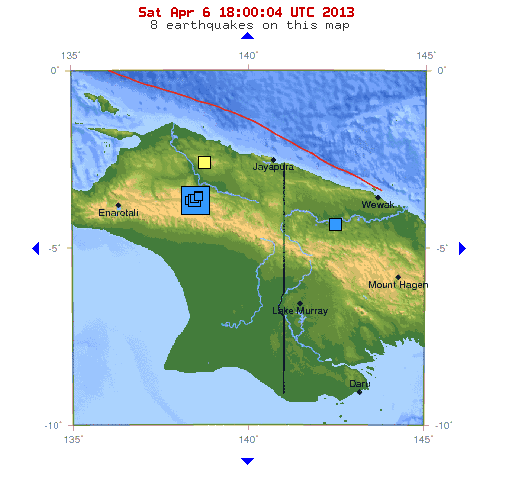
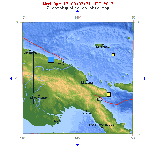
A third major earthquake registering 6.5 magnitude struck Papua, New Guinea Wednesday, April 23, 2013. On April 6, 2013, a 7.0 quake hit within the western side of the island country in Papua, Indonesia. Ten days later on April 16, 2013, a 6.8 shocked the eastern side of the island in Papua, New Guinea. Now, one week later, a 6.5 magnitude (USGS)/6.6 magnitude (Disaster Alert), hit offshore in the New Ireland region of Independent Papua, New Guinea.
The Ring Of Fire
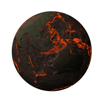
The Ring of Fire along the Western Pacific Rim and Papua New Guinea.
Typically, 90 percent of all earthquakes and 75 percent of all volcanic eruptions occur along the Pacific Ring of Fire, a 40,000 km (25,000 mi) horseshoe shaped area along the basin of the Pacific Ocean where large numbers of earthquakes and volcanic eruptions have historically occurred, and, hence, its name. The Ring of Fire stretches from New Zealand, along the eastern edge of Asia, north across the Aleutian Islands of Alaska, and south along the coast of North and South America. The Ring of Fire is a nearly continuous series of oceanic trenches, volcanic arcs, and volcanic belts with active crust movements.
The entire west coast of the United States falls along the Ring of Fire, and a massive network of faults runs underneath California, Oregon and Washington states. The Ring of Fire is roaring to life as the Earth becomes more active, and the areas around the globe that commonly do not see major earthquake or volcanic activity are waking up.
No Tsunami Warning
Fortunately, no tsunami was generated by this third major quake, but flooding is eminent in this island region, as well as in Hawaii. With this much shaking along the Ring, the oceans waters are stirring.