5.5 Earthquake Parts The Red Sea

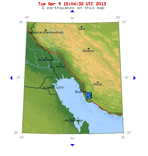
Merely one week after two large earthquakes hit in Uganda and two quakes struck Yemen, a 5.5 magnitude earthquake again split the Red Sea, July 8. 2013.

A small world globe showing the Middle East and the Red Sea.

The parting of the Red Sea has been happening slowly over the past 30 million years. We may be at the point in history when a major split forms another sea.

Parting Of The Red Sea

Over a period of three weeks in 2006, the crust on both sides of the Red Sea moved apart approximately 8 meters (26 feet), and magma rose out of the Sea. The molten rock  – enough to fill a football stadium more than 2,000 times – was injected along a vertical crack under the Red Sea, forming new crust and splitting the Sea open.

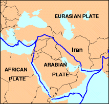
For the past 30 million years, Africa and Arabia have been moving apart, and this is what originally formed the Red Sea. The Earth is continually moving in this region, and the Red Sea is parting much more rapidly now than ever recorded.

The motion is episodic and jerky, and the split in 2006 added to the tearing of northeast Ethiopia away from the rest of Africa, and eventually another new sea will form.

Earthquakes And Tsunamis

A picture of an alarm clock.

Millions of years have already past, so it may be time for a major split in the Red Sea.

Major Earth movements typically take millions of years, but we tend to forget that what has already shifted in this region HAS taken millions of years.

Modern humans tend to think that the clock starts ticking at the moment we “discover” these geologic events. Today, time may be up, and the Red Sea may be ready for a final split.

Africa, the Indian Ocean, Arabia, and the Mediterranean Sea are exhibiting an increase in large earthquakes and tsunamis today, so keep in mind that the alarm clock may be ready to go off.


Earthquakes Increase In Middle East Amid Political Tension

While political tension in the Middle East increases, no one is paying attention to the fact that the Earth is building up pressure off their borders. Many people do not understand that the Earth is much more powerful than humans, and this may soon become evident as earthquakes increase in the Middle East. The chance that a tsunami could flood this area is very real. No one is paying attention to this possibility.

USGS Map of Iran Earthquakes

USGS Map of Iran Earthquakes On the Persian Gulf

Earthquakes Continue In The Middle East

Eathquakes continue to rattle Iran along the Persian Gulf and along the Iran- Pakistan border. On May 5, 2103, the tension increased along the Arabian Plate when a 4.9 magnitude quake shook the Gulf of Aden, south of the Red Sea.

The Arabian Plate

A picture of the USGS map showing the Arabian tectonic Plate

USGS Map of the Arabian Plate

The Arabian Plate and the Eurasia plate are colliding, and over time, many cities and oil refineries will be in danger of destruction from earthquakes, tsunamis, and volcanoes. The Arabian Plate was part of the African Plate about 500 million years ago. As the plates spread apart, the Red Sea, the Gulf of Aden, and the Persian Gulf formed. As more earthquakes occur in these areas today, it is a reminder to us all that this area is unstable, geologically, and countries should rethink where they concentrate their populations, how they construct their cities, and where they position power plants and nuclear facilities.

Maybe if we focus more on upcoming Earth changes, we might reconsider how we handle the present “human conflicts” this area faces today.