African Earthquakes Shift Into Middle East

A map of Africa showing Uganda.

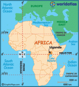
Two large earthquakes in Africa create movement in the Indian Ocean and in the Middle East.

Two days ago, I posted a blog about two large earthquakes in Uganda, Africa, and I wrote:

Keep an eye out for more quakes in this region because they may be a signal that large movements are setting up in the Indian Ocean, east of Africa, in the Middle Eastern regions, and north of Africa in the Mediterranean Sea.

Well, it happened two days later on July 5, 2013 – three quakes hit east and north of Africa.

  1. 4.7 – Mid-Indian Ridge
  2. 4.8 – Yemen
  3. 4.5  – Yemen

Now, keep an eye on Greece.

Uncommon Quakes

Even though Uganda’s East African Rift Valley is one of the most active earthquake zones in East Africa, it is not common for Uganda to experience large earthquakes. When I saw two large quakes occurring within hours of one another on July 3, 2013, I figured that this signaled movement yet to come east and north of Africa.

And, it did.

The Indian Ocean is an area that experiences many strong earthquakes, and in 2004, the Sumatra megaquake spawned the devastating tsunami that slammed into Sri Lanka and southern India. When I see movement in Africa, I watch for movement in the Indian Ocean and in the Middle East.
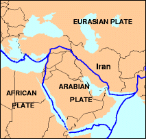
The Middle East

A map of the Middle East showing Yemen

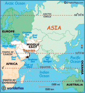
Two earthquakes strike in Yemen two days after the Ugandan quakes.

Frequent and large earthquakes are also unusual in the Middle East, but they are beginning to occur more often these days, and this is something we need to watch carefully.

A Biblical scholar once told me that the End Times were near when a tsunami hits the Middle East. I am not one for apocalyptic predictions, but a Middle East tsunami is a possibility in the near future. Especially as more quakes strike in countries along the Persian Gulf and Arabian Sea, like Yemen.

All we can do is wait and see.


Earthquakes Increase In Middle East Amid Political Tension

While political tension in the Middle East increases, no one is paying attention to the fact that the Earth is building up pressure off their borders. Many people do not understand that the Earth is much more powerful than humans, and this may soon become evident as earthquakes increase in the Middle East. The chance that a tsunami could flood this area is very real. No one is paying attention to this possibility.

USGS Map of Iran Earthquakes

USGS Map of Iran Earthquakes On the Persian Gulf

Earthquakes Continue In The Middle East

Eathquakes continue to rattle Iran along the Persian Gulf and along the Iran- Pakistan border. On May 5, 2103, the tension increased along the Arabian Plate when a 4.9 magnitude quake shook the Gulf of Aden, south of the Red Sea.

The Arabian Plate

A picture of the USGS map showing the Arabian tectonic Plate

USGS Map of the Arabian Plate

The Arabian Plate and the Eurasia plate are colliding, and over time, many cities and oil refineries will be in danger of destruction from earthquakes, tsunamis, and volcanoes. The Arabian Plate was part of the African Plate about 500 million years ago. As the plates spread apart, the Red Sea, the Gulf of Aden, and the Persian Gulf formed. As more earthquakes occur in these areas today, it is a reminder to us all that this area is unstable, geologically, and countries should rethink where they concentrate their populations, how they construct their cities, and where they position power plants and nuclear facilities.

Maybe if we focus more on upcoming Earth changes, we might reconsider how we handle the present “human conflicts” this area faces today.