North And South Poles Are At It Again

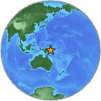
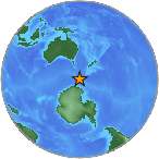
USGS small globe showing the Bellany Islands off Antarctica

The Balleny Islands off Antarctica – USGS

There’s been some major movement at both the North and South Poles over the past two days, and the equatorial regions are now responding.

The Poles

On October 28, 2013, a 5.3 magnitude quake shook the northern Mid-Atlantic Ridge between Greenland and Iceland. Approximately six hours later, the Antarctic Plate responded with a 4.5 magnitude quake south of Africa off the Prince Edward Islands.

Two hours later on October 29, 2013, a 6.0 magnitude quake shook the Antarctic Plate between Antarctica and South America at the Balleny Islands.

Less than an hour later,  Leavenworth, Washington had a 3.3 quake, a small 2.5 earthquake rattled south of San Francisco, and Nikolski, Alaska had a 4.3 and a 5.0 magnitude quake an hour apart.

South America
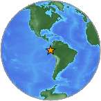
USGS map of quake off Peru

Recent quakes off the South American coast – USGS

After the 5.3 quake shook west of Iceland, the following quakes have occurred off the west coast of Central and South America:

  1. 2.8  Alberto Oviedo Mota, Mexico
  2. 4.3  Coquimbo, Chile
  3. 4.6  Ovalle, Chile
  4. 4.5  Chirilagua, El Salvador
  5. 5.0  Chivay, Peru
The USGS small globe showing the June 2013 earthquake in Papua New Guinea

Quakes at Papua New Guinea – USGS

Japan and Indonesia

The following quakes have occurred in the western Pacific around Japan and Indonesia:

  1. 4.6  Papua, New Guinea
  2. 5.3  Papua, New Guinea
  3. 5.0  Japan
  4. 4.7  Kuripan, Indonesia
  5. 5.0  Fiji
  6. 4.3  Kendari, Indonesia
  7. 5.1  Fiji
  8. 5.2  Sarangani, Philippines

US and Alaska

  1. 3.0  King Salmon, Alaska
  2. 3.0  Fort Yukon, Alaska
  3. 3.3  Leavenworth, Washington
  4. 2.5  East Foothills, California
  5. 2.5  Lompoc, California
  6. 4.3  Nikolski, Alaska

Caribbean

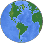
The USGS small globe showing the Caribbean earthquake April 30, 2013.

Caribbean earthquakes – USGS

  1. 3.0  Puerto Rico
  2. 2.8  Puerto Rico
  3. 3.1  British Virgin Islands
  4. 2.6  Puerto Rico

There’s a lot of movement all over the world right now. Watch for more activity off the US, Central American, and South American coasts.
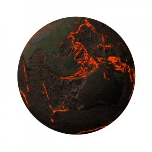


Continuous Large Quakes Signals Earth Movement

A picture of the Earth and the Ring of Fire with rising magma along the tectonic plates and cracks near Papua New Guinea.

The Ring of Fire along the Pacific Rim is a very dangerous earthquake zone.

After a 7.2 magnitude quake struck the Philippines less than 19 hours ago, this island country has had continuous earthquakes 5.0 and above.

An earthquake swarm like this is a sign of future volcanic eruptions, a big shift at the Pacific Rim (Ring of Fire), a pole shift, or all of the above.

Philippine Quake Swarm

Over the past 9 hours,  quakes continue to hit the Philippines:

  1. 5.2
  2. 5.0
  3. 5.5
  4. 5.9
  5. 5.4
  6. 5.1
  7. and more to come?

Volcanic Eruptions

Now, we should watch for an increase in volcanic eruptions all along the Ring of Fire. This includes:

  1. Alaska
  2. the Western US
  3. Central America
  4. Mexico
  5. South America
  6. New Zealand

Release of Pressure Or A Pole Shift?

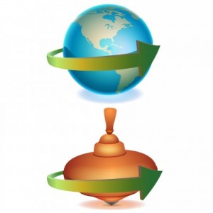
A picture of the Earth and a toy top comparing how the Earth spins like a toy top.

The Earth spins and wobbles like a toy top, making it unstable as it spins.

If the Earth is merely “releasing” pressure like a pressure cooker needing to vent, well, this is a good thing. If the Earth’s poles are wobbling again and slipping, even the slightest bit, this can be a bad thing.

When the poles slip due to precession, weight at the poles, and general rotational instabilty, we typically experience major shifting at the crust.

This results in volcanic eruptions and large earthquakes both at the polar regions and along the equator.

A man pointing to Portugal on a map of the Earth.

Track the earthquakes and volcanic eruptions for the patterns that show Earth movements.

Track The Movement

Pay attention to the location of the upcoming quakes, 5.0 and above. See if these quakes are where volcanoes are active.

Put 2+2 together, and you’ll know if we have a mere release of heat and pressure, or if the poles are, indeed, taking a dip downward.

5.7 Quake In Greenville, California Starts Earthquake Swarm

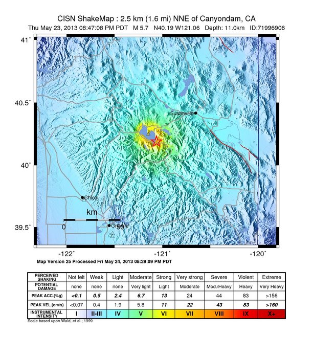
A USGS map of the May 23, 2013 quake in Greenville, California

May 23, 2013 quake in Greenville, California (click to enlarge)

A 5.7 earthquake struck Greenville, California late Thursday night, May 23, 2013, but the quake didn’t stop there.

The Greenville area experienced 62 quakes following the 5.7 rumbler, with the largest quake a 4.9 magnitude.

The initial earthquake was felt in downtown Sacramento, about 145 miles south of the quake’s epicenter.

Juan de Fuca

The next day on May 25, 2013,  more earthquakes occurred off the coast of Oregon (4.0) and in Coldfoot, Alaska (4.4).

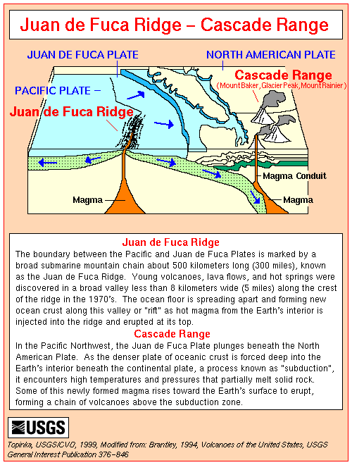
The Juan de Fuca Plate is one of the most active, and dangerous, crustal plates on our planet, and it is an area to carefully monitor for both upcoming earthquakes and volcanoes.

A USGS chart and map describing the Juan de Fuca tectonic plate.

The Juan de Fuca Plate off the USA Pacific Northwest – USGS (click to enlarge)

In the Pacific Northwest, the Juan de Fuca Plate plunges under North America. As the denser ocean crust is forced deep into the Earth’s interior beneath the continental plate at the USA’s West Coast (a process known as “subduction”), it encounters high temperatures and pressures that partially melt the rock. Some of this newly formed magma rises toward the Earth’s surface to erupt, forming a chain of volcanoes above the subduction zone.

Between the Pacific and Juan de Fuca Plates is a broad, submarine mountain chain about 500 kilometers long (300 miles) known as the Juan de Fuca Ridge.

The Juan de Fuca Plate will continue to dive beneath Oregon and  the High Cascades, so keep an eye on activity coming from the Juan de Fuca.